

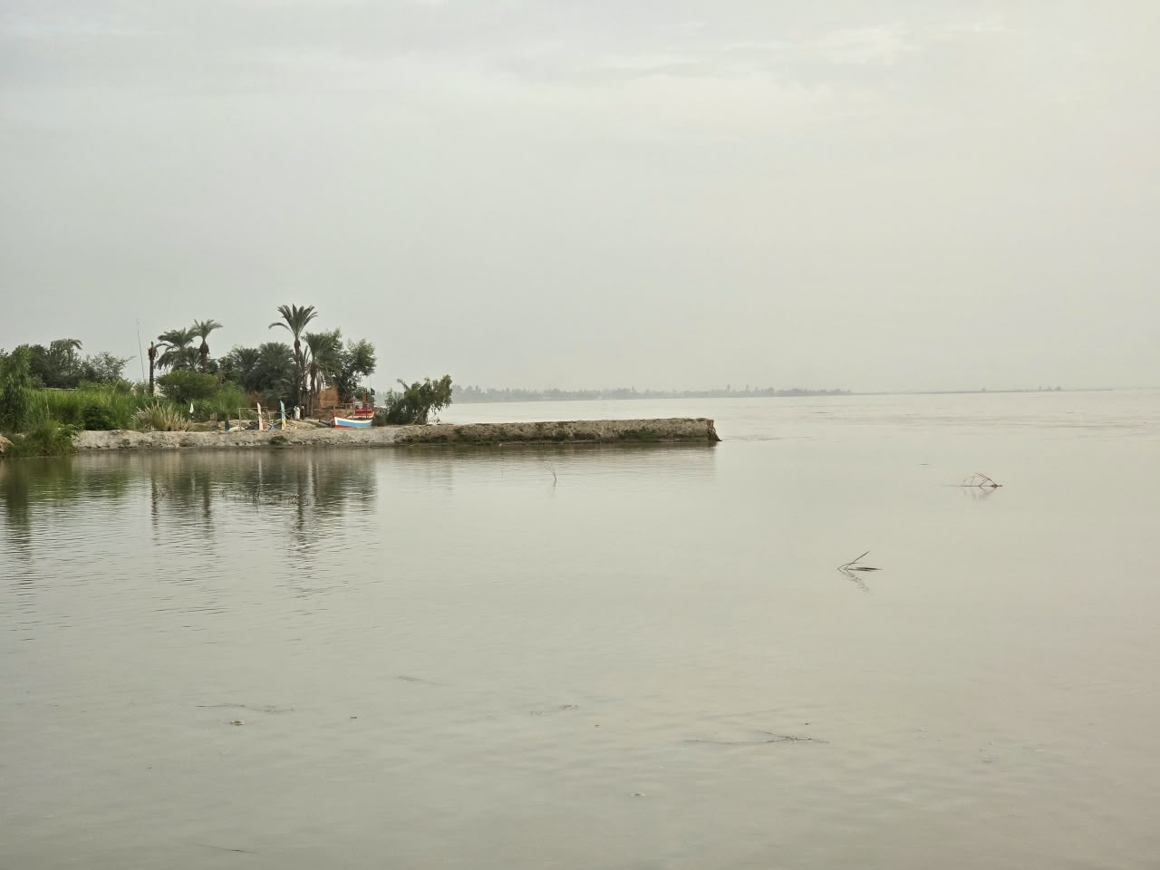
The Chashma Right Bank Canal, a wall of silt, and the eastward march of the Indus · September 2026
This essay explains how the Chashma Right Bank Canal and the recent eastward shift of the Indus River are partly connected. The connection is simple to state. The canal collected the floods of the hill torrents and delivered their silt to fixed points on the river’s west bank. Over twenty years, that silt built a wall. The wall is now pushing the river east, toward Layyah and the Nasheeb. This is the assumption we set out to test. The evidence comes from thirty-eight years of satellite imagery, read at one place: Churkin and its riverine belt in Taunsa. Here is what the record shows.
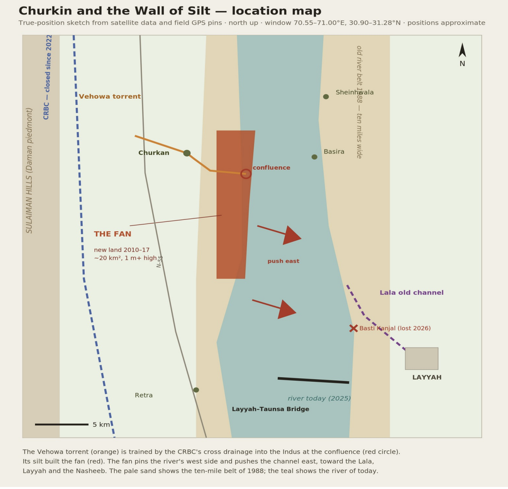
Figure 1. The setting. The Vehowa torrent (orange), trained by the CRBC cross drainage, meets the Indus at the confluence near Churkin. Its silt built the fan (red), which pushes the river east toward the Lala, Layyah and the Nasheeb.
Ask any old man of Churkin or Basira about the river of his childhood. He will say the Indus was 10 miles wide. The satellites agree with him. From 1988 to 1997, the active belt of the river below Churkin measured sixteen to eighteen kilometres. Ten miles of water, sand and moving channels. A wild and generous corridor. It flooded. It shifted. It gave land and took land. That was its nature and everyone knew it.
That river is gone. Today the belt is six to eight kilometres. At one place it is barely five. The old corridor has been squeezed into a narrow gut. From the east, the abandoned channels were quietly turned into farmland. From the west, something harder happened. A wall was rising. The canal called it flood management. It was also a silt delivery service. From 2003, when the cross drainage in this reach began working, every flood of the Vehowa torrent carried its full load of mountain sediment to one fixed point on the west bank, below Churkan.
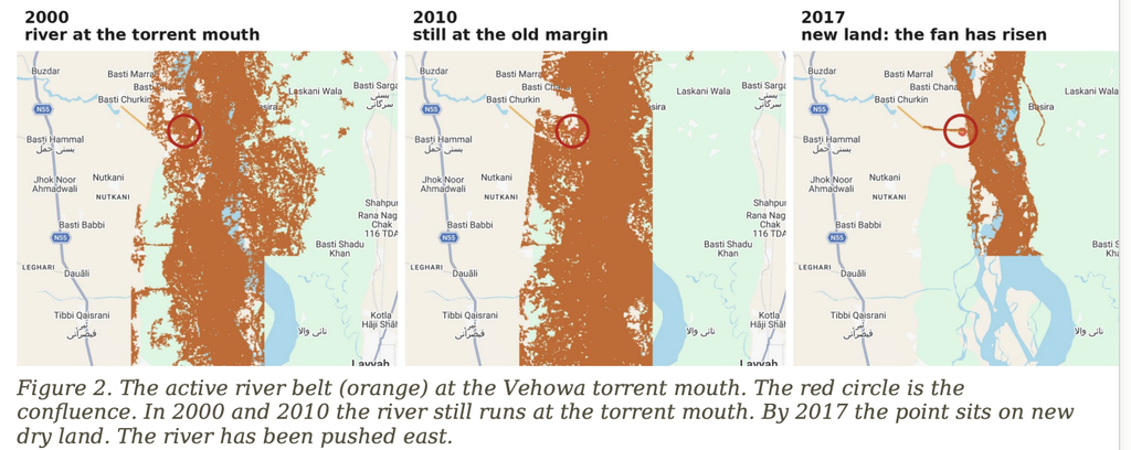
Figure 2. The active river belt (orange) at the Vehowa torrent mouth. The red circle is the confluence. In 2000 and 2010 the river still runs at the torrent mouth. By 2017 the point sits on new dry land. The river has been pushed east.
For a decade nothing seemed to change. In 2000 and even in 2010 the river still pressed its old western margin, as Figure 2 shows. Then the deposits crossed a threshold. Between 2010 and 2017 a fan of new land rose out of the river at the torrent mouth. We have measured it. About twenty square kilometres of new permanent land. At least one metre high on average, higher at its core. On the order of one hundred million cubic metres of sediment. The floods of 2010 and 2022 both bit into it. Both times it came back within two years. It is consolidated ground. The river cannot reclaim it. And downstream at Retra, where no torrent enters, the western edge has not moved in thirty-eight years. Same river. Same floods. Only the silt is different.
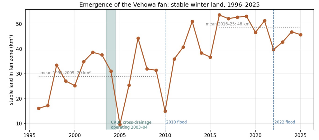
Figure 3. Stable land in the fan zone, 1996 to 2025. Flat at about 29 square km until the canal’s silt piled up. Then the jump: 2011 to 2016. The new land holds at about 49 square km. The floods of 2010 and 2022 could not remove it.
Now see how a wall moves a river. A river needs room. Take away ten miles and give it four, and the same flood must run deeper and faster. Faster water digs harder at whatever bank it touches. The fan does one more thing. It is a solid shoulder on the west side. Every flood that comes down this reach is nudged off that shoulder and sent at an angle toward the east bank. The east bank is soft floodplain, not consolidated fan. So the river eats east. Each year of eating shifts the deep channel further east. Each shift aims the next flood deeper into the eastern side. A wall on one bank becomes a ratchet. It only turns one way.
That ratchet is now turning above Layyah. The deep channel has already swung east across the reach below the fan. East of the river lies the Lala, the old abandoned channel of the Indus that runs along Layyah city. In 2026 the gap between the river and the Lala closed to a few hundred feet at one point. If the ratchet keeps turning, one flood will make the connection. The Indus would then send its water down a course it left long ago, through the Nasheeb, the low lands where villages, schools and roads now stand. This is not a prophecy. It is geometry. The wall is permanent. The push is permanent. The direction is east.
The ADB was informed at the very start. Some local people told the Bank that any disruption of the hill torrents and their silt deposition cycles would fail the canal. They proved right. The torrents beat the canal again and again, and since the floods of 2022 it stands closed. That failure is already on the record. What the record does not yet contain is this: the damage did not stop at the canal. The new evidence shows the impacts extend to the Indus itself. The silt the canal delivered has changed the river’s behaviour, is changing its course, and now places Layyah and the whole Nasheeb at risk. The canal has died. Its wall lives on, and the river is still answering for it. The Bank closed this file in 2004. The river has reopened it. So should the Bank.
Note: provisional analysis from 38 years of Landsat imagery and two satellite elevation models. Positions and volumes are estimates. The canal attribution rests on satellite evidence and the CRBC cross drainage commissioning period (2003–04); archival confirmation is being sought.